


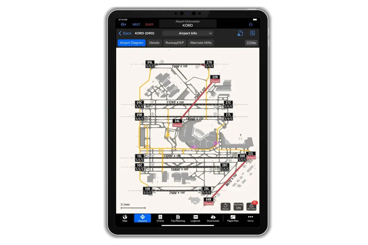
Garmin has announced updates to its SmartCharts feature within the Garmin Pilot app, introducing a new Graphical NOTAMs overlay designed to help pilots better understand active or conditional surface closures. When enabled, the overlay displays runway, taxiway, and ramp closures in clear color-coded formats, with red marking fully closed areas and yellow indicating conditional closures that require pilots to review accompanying NOTAM text. Runway labels also show FICON codes, helping pilots quickly assess surface conditions. Time-based closures include a visible clock icon for added clarity.
Alongside the NOTAM enhancements, Garmin has introduced a new weather feature called Storm Tops to the Garmin Pilot mobile app. This tool depicts storm height and intensity, supporting pilots in deciding whether to navigate around, through, or above weather systems. The update follows the recent addition of Storm Tops to Garmin Pilot Web.
SmartCharts is available through the Garmin Pilot Premium subscription for iOS users in the U.S. and the Bahamas. Garmin continues to focus on providing technology that supports general aviation, business aviation, rotorcraft, advanced air mobility, government and defense sectors, and commercial aviation. The company highlights that its aviation technologies aim to assist pilots in planning and decision-making across various operating environments.


Leave a comment